 Spatial Manager for AutoCAD Professional 9.6.1.17012
Spatial Manager for AutoCAD is a powerful AutoCAD plug-in designed for AutoCAD users who need to import, export, convert and manage spatial data in a simple, fast and inexpensive way, including many hitherto unseen functionality in AutoCAD. It is a lightweight application that runs inside AutoCAD and allows users to import and export geospatial data between AutoCAD drawings and geospatial files, data servers database or data warehouse, basemap display, alphanumeric data and data table management, terrain model and contour creation, location search, coordinate system conversion, and many geospatial functions another reason.
Some key features of Spatial Manager for AutoCAD include:
- Import spatial data into AutoCAD (Data Providers list): Import spatial data into new or existing AutoCAD drawings, as AutoCAD objects and Extended Entity Data (EED/ XDATA).
- Export spatial data from AutoCAD (Data Providers list): Export objects from drawings to a spatial file or database and save their Extended Entity Data (EED/XDATA) they are in the form of alphanumeric data tables.
- Coordinate transformation: Calculate geometric transformations of objects during import and export.
- Convert drawing Coordinate System: Convert the Coordinate System (CRS) of the entire drawing or a set of selected objects
- Basemaps: Choose from a variety of Dynamic Basemaps from providers like Google Maps, OpenStreetMap, Bing, MapBox, Ordnance Survey, and more. or configure your own maps from a TMS, WMS or WMTS server.
- Publish to Google Earth: Export all or part of the objects in the drawing's Visibility Layer and their data to a KML or KMZ file.
- Thematic Map: Visualize objects coloring them depending on their field values.
- Data management, queries, and publications: Manage the alphanumeric data associated with objects, and design and edit the structures that will be used to store the data.
- Data Grid: The Data Grid panel allows you to view, edit, etc. object's data in any table in the drawing. You can also select objects from the Data Grid, export data from tables, and more
- Field Calculator: Calculate simple or complex expressions using operators and functions that can be applied to field values in a table and/or to constant values.
- Spatial analysis: Perform spatial analysis operations on objects in the drawing, creating new objects from that analysis.
- Drawing tools: Drawing tools make your life easier by allowing you to perform actions directly on the drawing.
- Image tools: Space Manager's image tools let you efficiently manage your work with raster images.
- Location tools: Location and geocoding tools help add references and advanced data to existing objects.
- Google Street View integration: Browse Google Street View animations on any drawing or georeferenced map.
- Rubber Sheet: Allows you to geographically align two or more graphic data sets by selecting matching coordinates between them.
- Label Objects: Label data values from tables attached to objects as Text.
- Terrain: Create Terrain and other related objects (3D Points, Contours, etc.) from 3D data or from the Elevation service.
- Import Task: Save a Task to replay import processes (including all process parameters) as many times as you like.
- Multilingual: Available in English, German, Spanish, French, Russian and Portuguese.
Overview, Spatial Manager for AutoCAD is a powerful and flexible tool that helps users process spatial data effectively in the AutoCAD working environment. If you are working with spatial data in AutoCAD, this application will definitely be a good choice to help you complete your work quickly and accurately.
- XMind 2025 v25.07.03033
 The mapping tool most popular thinking there is a new stage with the look more fresh
 - Tecplot Fieldview 2025
 Technical and technical software of the Intelligent Light company in the field of engineering analysis on models.
 - MeshCAM Pro 8.43 Build 43
 A powerful 3D machine application developed by GRZ Software, this is the fastest way to generate gcode.
 - HalfpriceSoft ezCheckPersonal 5.0.6
 A software designed to help individuals and small business owners print checks that look professional
 - GVERSE GeoGraphix 2022.1
 Provides advanced tools for geologists, geophysicists and physicists to interpret and analyze data
 - GRLevel3 2.97
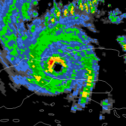 Windows viewer to store and live NEXRAD Level III data for Local Storms and severe weather warnings
 - GMapCatcher 0.8.2.0
 The program is designed to provide you the appropriate means to see the map of a particular geographic location.
 - FWsim Pro 3.1.1.6
 The software design and simulation of fireworks display, designed for fireworks companies and fireworks, was designed for the United States.
 - Email Extractor Pro 7.3.4.3
 The best all-in-one email and phone search and extraction software
 - Eliis PaleoScan 2023.1.1
 A new software to interpret 3D earthquakes for data download, information screening